Live maps
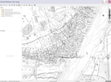 Live Maps" is the GIS platform where we provide access to georectified maps, but also where we process various sets of historical data to produce vectorial layers like the street grid, location of temples, etc. By checking the various boxes in the left-hand side menu, one can combine original historical maps (rasters) and topical data (vectorial layers). As the project develops, we plan to associate historical photographs to known locations in the city of Beijing.
To get access to the Virtual Wuhan GIS platform, just click on this link (or on the image on the right).
Last update on Wednesday 17 February 2016 (12:24) by G. Foliot